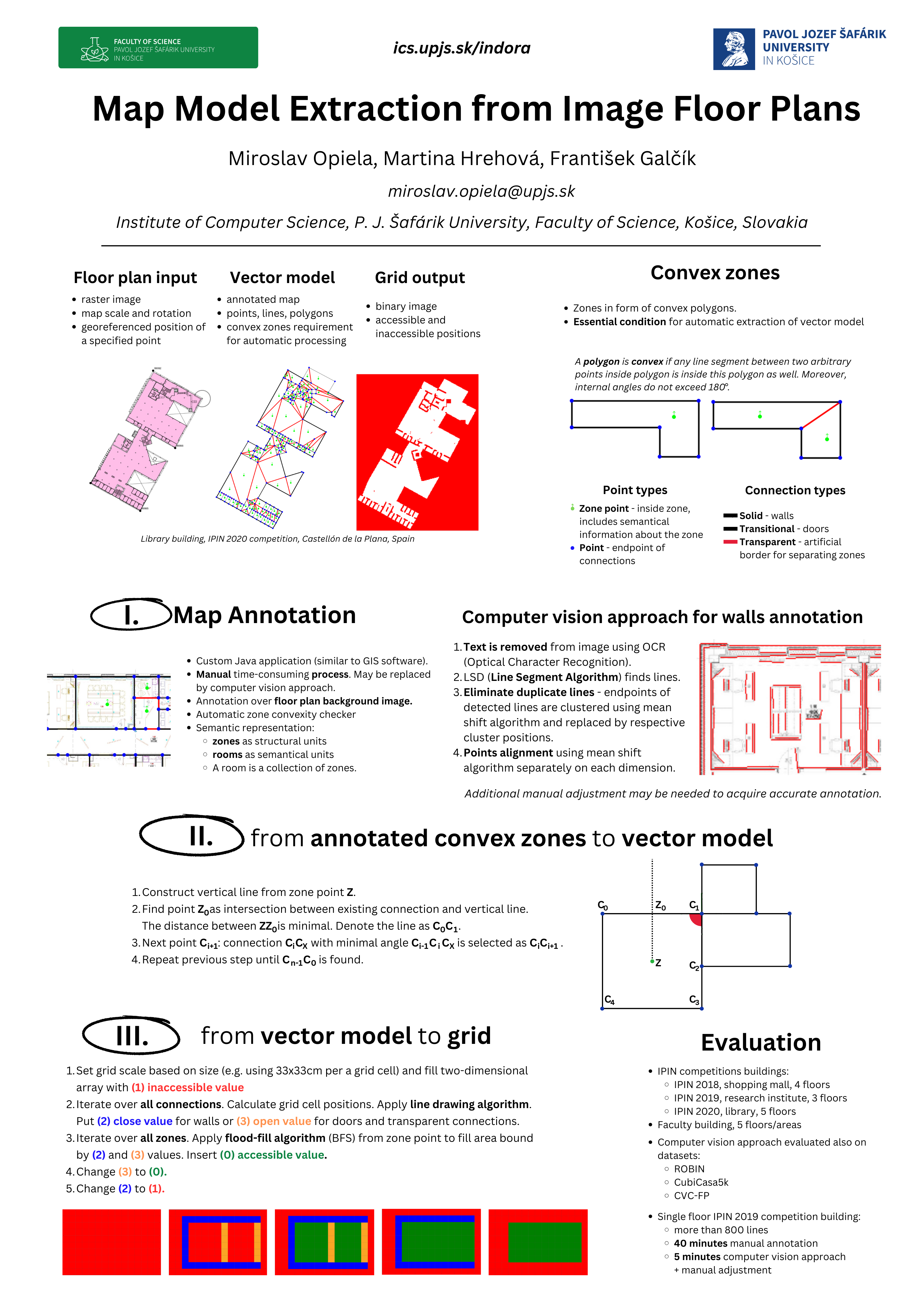
 Map model is essential for positioning in our approach. The map is annotated manually and the vector map model is extracted automatically using our custom application. The grid raster used in positioning method is automatically generated from the vector model.
In recent research, computer vision methods have been applied to reduce the time needed for map annotation.
See more:
- Map model extraction from image floor plans (IPIN 2023 conference, Work-in-Progress paper)
- Martina Hrehová. Computer vision map extraction from floor plans. 2023, master thesis
- Poster (presentation)